Monday, 18 March 2019

Trawsfynydd to Dolgellau

(Above) Llanelltyd Church

After the walk to Tomen-y-Mor, we did a linear walk starting at Ganllwyd on A470 (between Dolgellau and Trawsfyndydd) and walked in a northerly direction taking the forestry cycle track on the left after crossing the river.  This track is sometimes referred to as the Roman Road or Sarn Helen and climbs uphill through a coniferous plantation emerging in open countryside where the track follows a contour below the slopes of Craig y Penmaen.  Further on, where the path splits, take the higher route and then drop down to the road in the valley to the east passing Roman Kilns.  Follow the road to the left, passing a chapel and then bear right at Penystryd before crossing a fence into a field and heading uphill, following a wall for a while then keeping right over the left shoulder, but not heading towards the summit, of Moel Ddu.  The path crosses a number of streams as it rises towards a crossroad of paths at the gap between two hills.  Take the left path over a wall and continue on this path which drops down to eventually reach a farm, Plas Capten.  Follow the footpath signs through the farmyard to reach a track which joins a minor road at Bryn Goleu.  Turn left and cross the A470 into Trawsfynydd.  On leaving the small town at the northern end, cross the A470 and there is a green road opposite which rises uphill then drops down to a stream and follows a track which eventually reaches Tomen y Mur and the remains of a Roman Amphitheatre.  Our route was to head back over the A470 to follow the cycle path through the remains of the power station buildings and back to the nearby campsite.
 (Above) Signpost for Council Road and finger post showing Roman Road route

(Above) Coed y Brenin Medieval Bloomeries above the forest
(R) Chapel viewed from near Roman Kilns


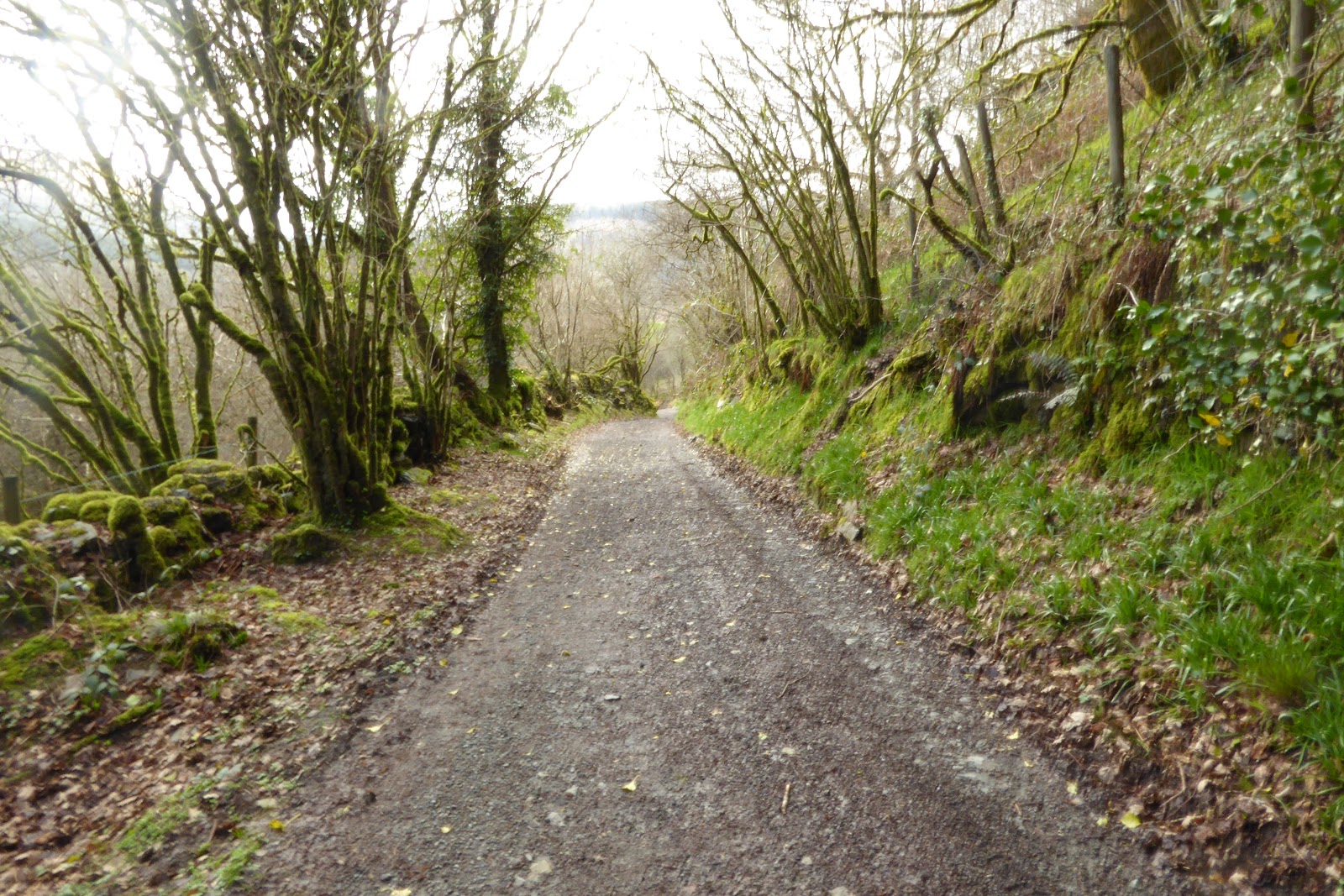
  View up to gap between two hills

 (Above) View of Trawsfynydd descending from hill.
(Below) Where track which joins a minor road at Bryn Goleu near Trawsfynydd


The next stage was to cover the route south from Ganllwyd but this took two attempts, first walking to the well marked route up stream to Rhaeadr Ddu  (Black Waterfalls) and then cutting south through the forest and heading right into open country at Goetre.  The path is well signed until Tyddyn bach where a sign indicated that the path goes left, eventually heading north back towards Ty’n y groes back on the A470.  At a later date we took the footpath from the minor road in Llanelltyd and a track joins the road on the right, immediately after the houses.  This clearly defined track cuts through the forest and rises up to open country below Bryniau Glo.  Here is follows a contour, cuts through a wall then goes to the left of a small hill to join another path from the left toward Hafod y fedw.  Keeping to the higher path, drop down to cross a stream then follow the wall for a while before veering to the right and dropping to the corner of two walls on the edge of the forest.  Here it joins a track.  Turn left crossing another stream and eventually reaching a pasture which gently climbs up towards Tyddyn bach.  The route, in either direction, requires careful map-reading as well as reference to the Cicerone Guide.  At Llanelltyd a track drops down the left hand side of the church to join a track that leads to the old bridge.  Upstream are the remains of Cymer Abbey and an excellent camp site.  Directly opposite the road from the old bridge is a track leading up hill towards a golf club and over the hill with woodland on the lefthand side to crossroads and the lane dropping down to Dolgellau.
 (Above) Lane up to Rhaeadr Ddu
 (Above) Rhaeadr Ddu  (Below) Bridge by falls to join Sarn Helen footpath
 (Below) Ruins near Goitre
 (Above) track into woods before Tyddyn Llan  (Below) Signpost to ignore - Keep straight on
 (Below) Tyddyn Llan (empty building)

(Below) Track dropping down to  Llanelltyd  (Bottom) Cymer Abbey

Tuesday, 28 August 2018

This entry is a bit out of sequence as we have missed out part of the route from Dolwyddelan to the B4391 near Llan Ffestiniog but we will come back to it soon. The  logistics of continuing from Dolwyddelan meant we needed more time and two cars as public transport is sparse. Unfortunately Mike, our fellow traveller, wasn't available until later in the month so we decided to continue with trying to plan a few circular walks which would take in part of the Sarn Helen Path

Our first day involved driving from home and finding the campsite so we only had time for a half day circular walk. This also provided us with an opportunity to try a small cafĂ©, near the planned walk, at Pont Afon Gam on the B4391. It was worth it and I recommend the hot sandwiches.

There is a parking spot a little further towards Llan Ffestiniog on the B4391 which is where we started this circular walk -


This isn't an ambitious walk but it takes in part of the new Slate Trail and part of Sarn Helen. It also follows the Afon Cynfal down a beautiful gorge with waterfalls that are picturesque .

Starting at the parking place cross the road at the foot path sign and proceed east following the path on the North side of the road, back towards the direction of the cafĂ©. This basically prevents the need to walk on the busy and narrow road back to the cattle grid, just before the cafĂ©,where the walk follows the route of the Slate Trail back west along the valley but on the south side of the road and along the gorge.

The slate trail is new and is well marked. Follow the route and the river until you reach a track and Bryn Mawr . Now continue along the track until you come to a T junction near Tyddyn Gwyn Bach and turn right up the hill on the metalled road. A short distance along this road a public path goes off to the right - this is Sarn Helen. Take the path and begin to walk NNE through the fields and gates until you again reach the B4391. Turn right and carefully walk back along the road to the parking spot where your vehicle is parked.

This was a pleasant afternoon saunter which gives good views of the waterfalls and doesn't take long - it also takes another mile or so off the Sarn Helen


The following day, having camped nearby, we again set off on a planned circular walk which would take in a small part of the Slate Trail, and then lead us to Sarn Helen - the main purpose of the day. Having set this as our objective we really did enjoy the walk along the Slate trail - another riverside walk with spectacular waterfalls and gorges. .

We had started our day by parking on the main A470 at Garth - a short distance to the west of  Bont Newydd. Leaving our vehicle in a layby we walked North on a public path back to the Afon Cynfal. This path wasn't well signposted and some of the stiles were a bit overgrown but not impossible. Once at the river you are back on the well signed Slate Trail.  Walk east towards Bont Newydd through some stunning gorges. Eventually you emerge at a metalled road and need to turn left,  after a short distance turn left again past some houses and continue to the main road bridge at Bont Newydd. Cross the road to the track opposite and you are now back on Sarn Helen.


The track then goes uphill towards a forest and then bears right. Eventually on the right hand side you will come to a pair of gate posts - mentioned in Cicerone. The path is sign posted to turn  right through the gate posts. The Cicerone guide however suggests continuing upwards.  As the footpath signs appeared fairly definite pointing through the gateposts, and there was a sign saying no right of way upwards, checked the map and  walked through the gateposts along a track which resembles a private drive. As you approach the buildings the path diverts to the right ( watch out for the small finger post on the right.)  Things get a bit overgrown here but he new signpost are visible until a point behind the buildings where the path is almost impassable and steep. We struggled on across a small stream and climb a steep slippery route through two new walker gates up to an area of cut forestry and then onto a forest vehicle track.

This seems to be a new diversion as the gates are fairly new but the path almost abandoned. I suppose that there aren't many walkers taking this route which also has a number of fallen trees blocking the path ( we intend to go back and investigate what would have happened if we'd followed Cicerone and ignored the signs. if someone else does it first please let us know - the difficult path will be reported to the Council.)
Once we were back on the forest track we turned right, within a few yards the footpath bears left off the track at the footpath signpost. This goes uphill off the track.

The path isn't very well defined in this section but the route is generally uphill - there will be a radio mast that becomes visible as you climb. Eventually you will come to a green lane. Turn right and follow the lane west. The lane should swing to the south and the Mast until it joins a metalled road. pass the mast and the lane becomes a dog leg right before arriving at  Tomen Y Mur Roman Fort. This is well worth having a look at.


After a break from serious walking of nearly a year we are now resuming our research of Sarn Helen. We are still comparing our experiences and the route to that described in the Cicerone Guide for the walk and hope these notes will compliment the descriptions and information in the guide.

In our last entry we left the walk at Dolwyddelan, having shown the two possible routes of the Roman road from Betws ( miners Bridge) and from Ugly House.  We now take up the walk going South from Dolwyddelan. Because of the remoteness of this section in relation to public transport we are going to break the route into sections and add in more of the Countryside to create circular walks so walkers can get back to their vehicles. This first walk is approximately 9 miles ( approx. 4 miles of Sarn Helen and 5 miles back over Y Rowen)

We again parked on the High Street near to the War Memorial. We then walked South over the river and rail bridges.  The guide book explains a route which initially takes in both sides of Afon Cwm Penamner , this route is now well marked so follow the blue footpath signs up into the forest along a well defined track. These signs become apparent as you turn right  after the river bridge and then left after the  rail bridges a short distance further on; the aforementioned forest track starts on your right. Ignore the lane down left to the station.  Watch out for the British Rail 6 ton weight limit on your right, the forest track is on the same side a few metres later.

(The alternative to this is to follow the road right just after the rail bridge which is marked on the OS map as the route of Sarn Helen but watch  for cars.)

This is a fairly moderate part of the walk and you will gain height gradually through the trees - occasionally seeing the road running in parallel to your right.

The walk through the forest is safe and pleasant, keep following the blue footpath signs and eventually you will be led down to a footbridge and a small parking area on the aforementioned road. Turn left here and follow the track south past Tan -y -bwlch farm and on through a gate to Ty'n-y-Cwm. Go through the second gate and bear left over a small bridge and stream. The track divides here so take the left hand path ( the narrow one of the two) over a second small bridge and continue towards the hills in front.  The only way South out of this Cwm (valley) is over those hills  so things now get a little more strenuous.

The path is still signed so don't turn off left or right at junctions but keep going until the path disappears through trees going steeply up.

The climb is hard but fairly easy to follow until you reach the crest and a stile. You cross the stile into open moor land with a fantastic view ( great lunch stop.) 

Instead of continuing on Sarn Helen from here we walked left - approximately NE - along the fence line of the forest and made our way towards Y Rowen. - a decent climb (594m).  The OS map shows a number of fences that can be followed to handrail a safe route through this access land. It's best to follow the fence as there isn't a defined path.  

The climb up to Y Rowen is rewarded with (in my opinion) one of the best views in Snowdonia.  To the west in the immediate foreground is the bulk of Moel Shabod; behind and to the South is Snowdon; and further to the left and south is Knicht.

The route down from YRowen is a green lane marked on the OS map, this is easily followed back to Dolwyddelan.   This is a great circular walk that advanced us on our way along Sarn Helen and got us back on the mountains to enjoy a great view. approximately 9 miles.

To try and meet up with where we left off  from the Sarn we did another circular from Cwm Penmachno. Having driven through the small village park on the left near a sign to the old slate works at Cwt -y bugall Quarry.  The track up to the quarry and works is well defined and the size of the old works surprising. An interesting place of industrial archaeology worth a look. Once you arrive at the works walk  up a steep incline near the tall chimney and you will see a track coming down from right to left. This is just before reaching Llyn Bowydd.  This track is Sarn Helen, continuing uphill to the right ( North) would bring you back to where we emerged from the woods above Dolwyddelan in our last section ( before we took the route over YRowen.) 


Saturday, 15 April 2017

 Dolwyddelan to Miners Bridge and return by Route 2. ( circular)

This post is a bit of a re run of the last section but in reverse from Dolwyddelan back along the last used route to Miners Bridge via Ugly House and Swallow Falls. We then turned the walk into a longer circular hike by returning on the OS 17 map marked route for Sarn Helen from Miners Bridge South to Dolwyddelan. This gave Helen a chance to catch up on the bit she'd missed and it also gave us chance to compare the two routes across to Dolwyddelan from the Afon Llugwy valley.

As this walk is mainly a repeat of the previous blog we've limited the photos and explanation to the new section from Miners Bridge South. It was also pouring down again so the views were limited.

The route is shown in a picture of our maps below - taken by this weeks photographer Helen.

On this walk we also came across a small convoy of 4X4 s on the deeply rutted path across from Dolwyddelan towards Ty Capel. Sarn Helen has sections like this which are shown on OS maps as "Other Routes with Public Access" (Green dots). These sections are also shown in various guide books used by 4x4 owners who want to off road.  On this occasion the drivers were friendly but seemed oblivious to the fact that they were completely blocking the path as they stopped for a break - causing a number  of cyclists to dismount and carry their bikes round the cars and walkers to leave the path onto muddy banking. The drivers were also not certain that they would be able to get out onto tarmac at the end of their planned route - a real adventure for them and an inconvenience for us.

 It's an interesting thought that this situation is legal unless the track is closed to vehicles by the authorities - this is a highway. All users of paths add to erosion and the need for repairs - look at any long distance walking route, but four or five heavy vehicles travelling in convoy, on an already muddy and deteriorating surface, causes a rapid change to the character of a track. The depth of the muddy puddles and water filled ruts where the bottom cannot be seen was out of the ordinary and unexpected. I stood in one by accident and found it a good 18inches deep and water came over my boots. Sometimes  puddles on a muddy track cannot be avoided, I'd hate to hit one of these holes on a bike, nor would I want any of the many Dof E students we saw carrying large packs to fall or inadvertently step in!

I don't know the answer to this, it could be that there is a need for legislation ( local or national) where rights are balanced with responsibility and access limited fairly for tracks to recover. 4X4 owners have a right of access just as Walkers etc. do. The drivers today were pleasant enough and had travelled to North Wales from the SE of England for an Easter Break - a boost to the local economy maybe, and a concern if such use increases. ( Soap box section finished!!)

After we dropped into the Afon Llugwy Valley from Dolwyddelan we made the mandatory stop for Coffee and Cake at the Ugly House tea shop before we walked down to Swallow Falls to take a few pictures.  After crossing the river at Miners Bridge we climbed out of the river gorge onto the main A5. At this point we cross the road onto the small lane opposite marked "Unsuitable for Motor Vehicles". Do not turn right up past the houses but continue to follow the main lane. In a short distance past the Houses on right and the entrance to Pentre Du farm left the track changes from a metalled surface to a shale and stone track - it also narrows and has gates.  Follow this track as it starts to climb - easy to follow on OS 17 - SSW-
Eventually you will come to a narrow footbridge across a fast stream, just keep climbing following the track without deviating to your left or right until you reach Ty Mawr where there is another gate.

After Ty Mawr and the gate continue on the track which will continue to climb - but only gradually - before it drops a little bending round to the right then left.  (You should ignore the footpath off to the left by a field gate before the bends). You should now be able to see the crest of the climb and there will be ruins on your right.  This path is now well rutted and stony as it continues fairly level onto OS 18 map. The route crosses a couple of forestry track and there is a crossroads where you could be tempted to go left  - don't.  Go straight on onto the narrower track dead ahead.

This route is simple to follow and you will start to descend towards the main A 470, passing a Llama farm and various holiday cottages (Fron Goch). As you descend into Pont Y Pant  look out for the path to your left just after a large White House - there is a stone stile to cross.  Cross the stile and walk almost back on yourself through the beautiful garden of the White House until you reach the main road through a small gate. There is no pavement so be careful stepping out of the gate.

At this point we crossed the road and the river bridge towards the Station and Ledr Hall ( another cafĂ©!!). Follow the station signs and the narrow road to your right.  Basically its now a gentle walk following the Rail line into Dolwyddelan where we had parked.

The total walk was about five and half hours of steady walking with and extra half hour in the cafĂ© at the Ugly House.  We didn't use sat map so have measured the distance by map as about 11.5 miles.

Personally, having now walked both routes over from Miners Bridge to Dolwyddelan, I prefer walking via Swallow Falls, the Ugly House, and Ty Capel - and not just for the cakes. The scenery is pleasant on both routes but the walk along the Afon Llugwy is excellent. The walk from The Ugly House to Ty Capel is easy and safe but gives fantastic views of Moel Siabod ( weather permitting.)
The other route is shorter and the climb steeper - it is also marked as Sarn Helen but both routes have a claim. the choice is yours.


Miners Bridge

Afon Llugwy Miners Bridge


Cross road but don't turn right up here

Keep straight on - correct path at my left shoulder

Path swings down to right then left

llamaarama!

Holiday cottages with seat to Will the wheels

Turn left off lane through Garden to A470

emerging onto A470

Cross A470 and river bridge then turn right

Dolweddelan

Sarn Helen views


Ugly House on A5 Great cakes!


The route

Sunday, 2 April 2017

Miners Bridge Betws y Coed to Dolwyddelan

This section was a about 7.5 miles from Miners Bridge in Betws Y Coed to Dolwyddelan.  The forecast for the day indicated it would rain but that it would brighten up later. The reality was a fantastic day - once the first ten minute down pour had exhausted itself. This day was also a day off for Helen who was giving a talk on HM Stanley and his artist wife Dorothy Tennant in Denbigh so I was joined by Mike Costello - who is largely responsible for the better photos on this bit of the blog.

You will remember that we finished the last section in the rain and dropped down into Betws y Coed for shelter and to pick up our car. The route doesn't actually go into Betws so we started this section at a point on the A5 just to the west of the town at the Old Miners Bridge over the river.  Its a good access point that enables a walker to get back onto the route shown by the LDWA and the Cicerone guide book. Having crossed the bridge there is a short but steep uphill section to a narrow metalled road. There is a choice here to walk along the road to the west or to climb further onto a path leading  up to Diosgydd Uchaf.  As it was still raining at this point, and the map shows the path uphill actually comes back down to the narrow metalled road we were on  (after about a mile) we chose to stay on the road.  This was the better choice as we had great views into the river valley to see the river in full force.

After about a mile the rain stopped and we re-joined the route of Sarn Helen proper at Diogydd Isaf - shown on OS map and in a photo.

Cicerone shows the need to do a short 50m uphill bit from here before turning left onto a path which doubles back downhill.. This was a pointless diversion as the path goes back virtually to Diogydd Isaf - where it can be seen from where we stood on the road.  We simply crossed the road at Diogydd Isaf onto the path and turned downhill back towards the river on the well marked track. Keep going downhill, ignoring minor paths on right, until you come to an obvious T junction overlooking the river and turn right. (Mentioned in Cicerone). This path is a bit muddy but is well marked. It is however narrow with a fence to the left separating the walker from a steep slope into the river. This path gets narrower with a cliff on your right and the drop to your left; it does give the reward of great views down to Swallow Falls not seen by the tourists on the observation platforms on the opposite bank. The description in Cicerone is a bit complicated compared to the above and mentions a Tea Room at  Allt Isaf which we didn't find. See page 50.

The marked path continues along the river with various viewing points and photo opportunities.  Eventually the path meets a metalled road adjacent to an Outdoor Pursuit Centre. Turn left here and drop down to the A5 and the Ugly House Tea Room - great coffee and cakes.

From this point the walker has some decisions to make. You can follow the Cicerone guide back up the lane ( North) adjacent to the Ugly House and turn left onto a path which eventually leads back to the A5 further west near the Army training camp. The second choice is to walk along the A5 towards Capel Curig until you pass the training camp and come to the path leading down to the Stepping Stones crossing the river.  We studied the map. We believed that the river was in full force and that the stepping stones crossing point would likely be underwater; we also saw that the A5 is extremely busy - with road works on the pavement - so we went for a third choice which in our view was safer and more likely to follow the line of the actual roman road ( see Cicerone).

Our choice seemed a no brainer - cross the A5 road at the Ugly house and walk across the main road bridge ( South) and then take the immediate right onto a narrow metalled road leading right towards the site of the Roman Fort Caer Llugwy (see OS map).

After a pleasant and easy walk along this quiet narrow metalled road you will come to the site of the Roman Fort on your right - its actually just a slightly raised area in a field with no public access.  After a further short distance along the road you will come to a stile over the wall between you and the river - this is where the path from the stepping stones crossing comes out.  We walked on in safety from traffic and with dry feet to the old chapel below Cerrig Gwynion ( now a holiday home on your left set back from the road). Alongside the old Chapel House there is an obvious track climbing south. Take this path and walk uphill away from the river. You will cross a small bridge with a gate and continue upwards.  This path climbs steeply up to a height shown on our GPS as 987ft. The track then levels out across the moor and gives great views of Moel Siabod and the hills to the North behind you. 

The track is shown on OS map as " other route with public access" - (green dots) and the track is obviously also enjoyed by mountain bikers and the occasional motor cross bike. .  The track is still pleasant despite the ruts and is easy walking and you eventually drop down into the forest.  Keep heading South on the main track and you will cross two main  streams with bridges over before you come to a point where the track splits into two. This is just above Dolwyddelan and both routes will eventually take you down to the A470.  We took the right hand turn ( left hand route has a lock bar to prevent vehicle access.) and dropped down towards the A470 along a steep narrowing track not suitable for vehicles - ignoring a further track off to the right which goes to a view point . The track down brings the walker out between houses on the A470 very near to the next path seen across the road. Cross over and through the small gate and cross the water meadow towards the war memorial and a small church.  We finished this section at this point.  It is a short distance from this point to the railway station where you can catch a bus or the train ( infrequent) back to Betws Y Coed.

This section was pleasant and an easy walk, again the Cicerone guide gives a number of options as have we. This walk was always going to rely on personal choice but I would not recommend walking for any distance along the main A5 from the Ugly House.  I also would not recommend using the stepping stones when the river is high.  I can however recommend the Ugly house tea room for morning coffee!.

Hopefully we will also have time in the near future to investigate an interesting secondary route from The Miners Bridge in Betws to Dolwyddelan (Cicerone page 67) Hopefully we can make a circular walk of this bit.
Start Diosgydd Isaf

Path down to river with Mike - proves he exists! Shows footbridge on the way down.


Narrow path above Swallow falls


Route from falls to Ugly House

Ugly House (not Ugly Mike) Great Tea Shop

Our suggested route - cross river here using main road bridge

Quiet Road towards Moel Siabod - Caer Llugwy to right


Caer Llugwy


Path from Stepping Stones Crossing - note River
Track up past Old Chapel from Road

Looking back towards gate and small bridge ( and Mike - needs more porridge on a morning!))

Roman Road bears right ( 987ft)

Across moor on Roman Road


Keep straight on

Moel Siabod and Blue Skies

Forest Track ( mike in front this time) Keep straight on

View back towards North and Siabod

Trail down into Dolwyddelen

Onto A470

Cross Road and head across water meadow towards Church
Crossing water meadow by river


Old Church Dolwyddelan. End